
LAKE POWELL
What Lake Powell is
The second largest reservoir ever built in this country, and three elevations that decide everything about it.
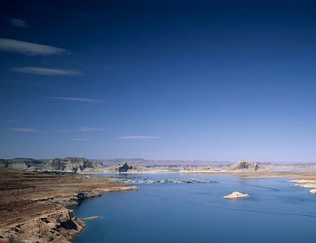
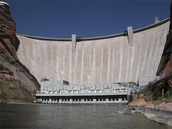
Lake Powell is 186 miles long with 1,960 miles of shoreline, more coastline than the whole Pacific seaboard of the lower forty eight states . It backs up behind a concrete arch 710 feet high , it holds two states, and today it is holding about 24 per cent of what it was built to hold .
Read the outline on this page carefully FULL POOL
The shape at the top of this page is the federal hydrography polygon for Lake Powell, and it is the lake at full pool, elevation 3,700 feet . That lake does not currently exist. The water is about 180 feet below that line. Every arm on that drawing is shorter now, and some of them are dry.
| Figure | Value | Source |
|---|---|---|
| Length | 186 miles | Reclamation , Park Service |
| Shoreline | 1,960 miles | Reclamation |
| Depth at the dam, full | 560 ft, or 561 ft | Reclamation , Park Service |
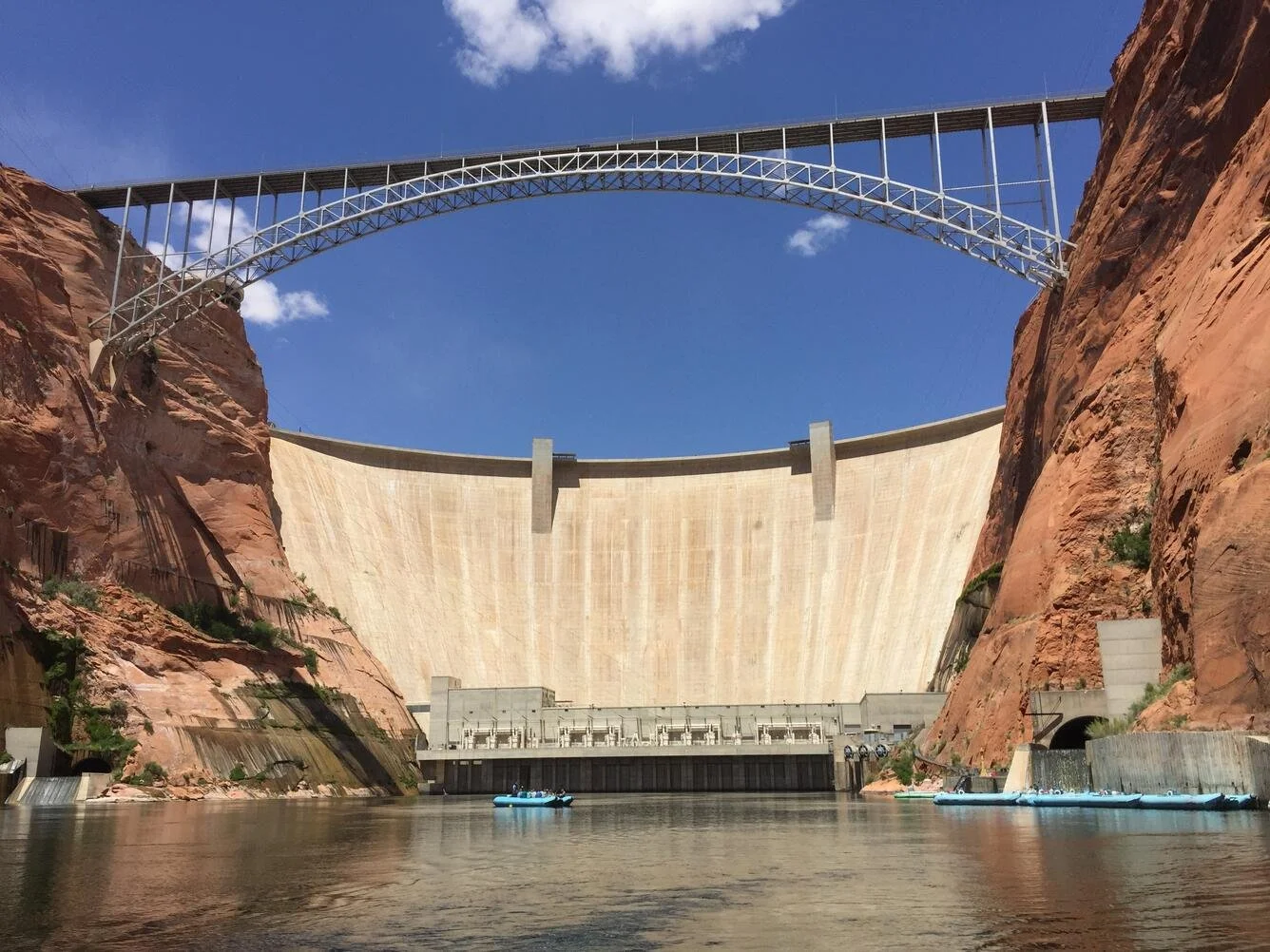
| Dam height | 710 ft above bedrock, 583 ft above the old river channel | Reclamation |
| Concrete | 4,901,000 cubic yards in the dam, 5,370,000 with the powerplant | Reclamation |
| Cost | 245 million dollars | Reclamation |
| Storage capacity | 25,160,000 acre feet, resurveyed 2018 | Federal survey |
| Side canyons | Over 90 | Park Service |
| States | Utah and Arizona | Federal hydrography |
Almost everything difficult about Lake Powell comes down to three numbers.
3,700 feet, full pool DESIGN
The top of the spillway . The lake has reached it in exactly five water years, all of them between 1980 and 1986, and never since .
3,490 feet, minimum power pool THE GENERATORS STOP
Reclamation is blunt about it: "Water cannot be released from the penstocks below a Lake Powell elevation of 3,490 feet." Below that line the eight generators cannot run and everything must go through four 96 inch pipes instead .
3,370 feet, dead pool NOTHING PASSES
The invert of the outlet intakes. Below it, in Reclamation's words, "water can no longer be delivered downstream." The Colorado River below Glen Canyon Dam would stop being a river fed by a reservoir and start being whatever leaks past.
The lake sat at about 3,521 feet in early August 2026 . That is roughly 31 feet above the point where the power stops and about 151 feet above the point where the water stops.
What was there first
A canyon almost nobody had seen, more than two thousand archaeological sites, and a bridge the law was supposed to protect.
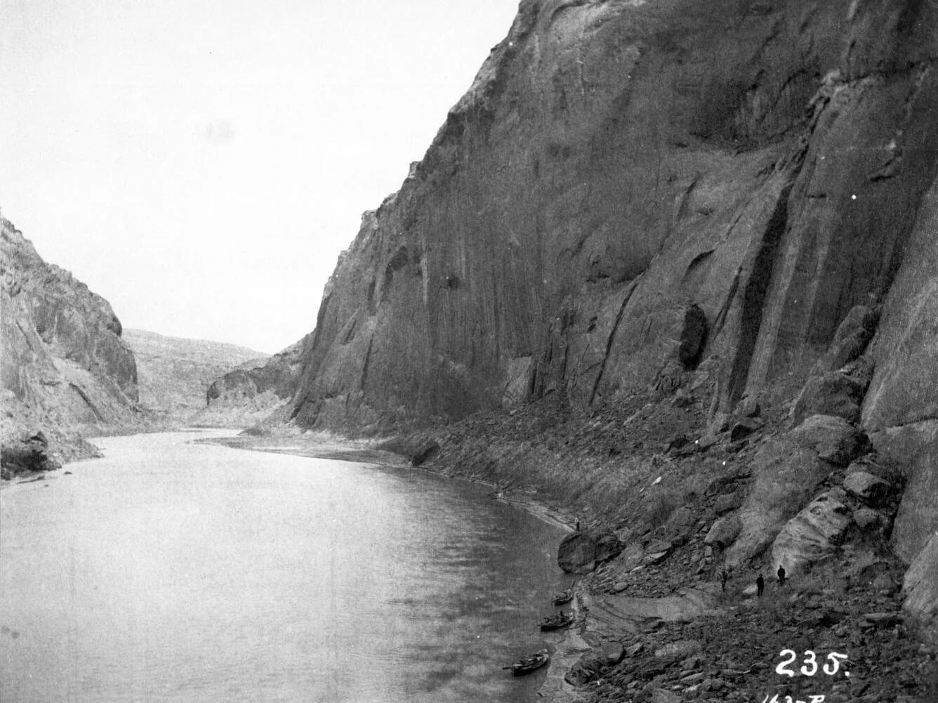
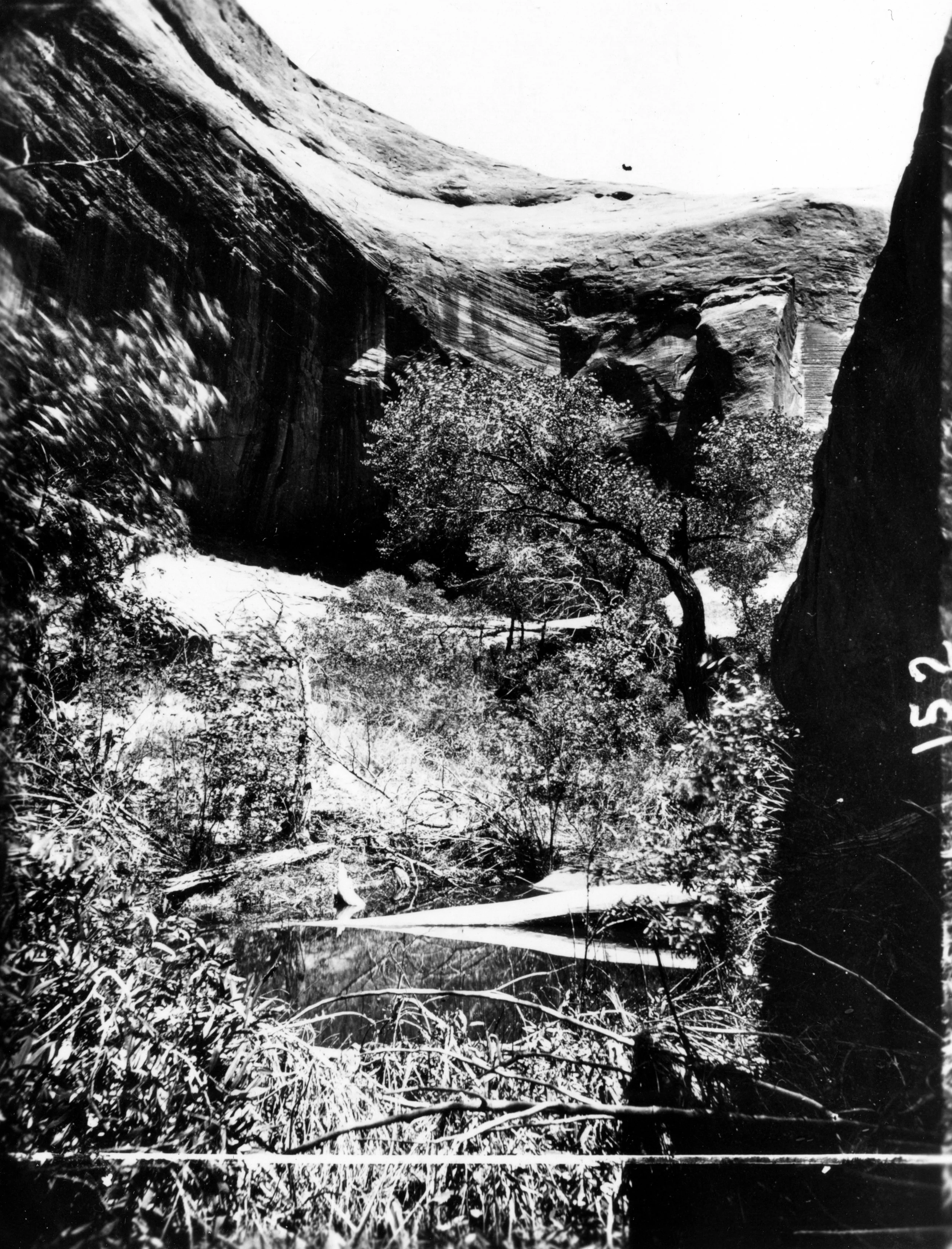
John Wesley Powell came down it in 1869 and gave it its name. He was not being romantic about it. Faced with a run of country he could not sort into categories, he wrote: "We decide to call it Glen Canyon." The glens were the oak set alcoves. It was a description, not a tribute.
Music Temple 1 AUGUST 1869
Powell named a chamber Music Temple on his first expedition, and on the second his crew carved their names inside it . A visitors register was kept there from 1938 and was carried out to safety in 1961, two years before the gates closed .
Be careful with what is on the map for this. The federal names database has no current record for the alcove. It carries only a historical record for the sand bar of the same name, which is what the pin in the map above is, and this page labels it that way rather than pretending the chamber is findable.
Other things went under with it. The Crossing of the Fathers, where the Dominguez and Escalante expedition forded the Colorado in 1776, is beneath Padre Bay under roughly 340 feet of water even now. Gregory Natural Bridge, a 127 foot span, was submerged in 1969. Hite, the town Cass Hite founded in 1883 after a small gold rush, and the ferry that ran there until 1964, are gone .
And more than two thousand archaeological sites 1957 TO 1963
The Glen Canyon Archeological Salvage Project, run by the University of Utah and the Museum of Northern Arizona under Park Service contract, recorded more than 2,000 sites ahead of the water . Roughly fifteen per cent of them were excavated. The rest were recorded and left.
Some of those sites have been out of the water again since 2021.
On 26 January 1880 a Mormon expedition of 250 people and 83 wagons went down a slot they had widened in the canyon rim and crossed the Colorado on Charles Hall's ferry . The notch is still there. It is now a feature on the shoreline of a reservoir, and it is pinned on the map above.
Charles Hall's name survived in a way he could not have predicted. The state highway ferry that crossed Lake Powell between Halls Crossing and Bullfrog was named the Charles Hall. It is not running. Utah's transportation department says it needs the lake at 3,565 feet, and the lake is more than forty feet below that.
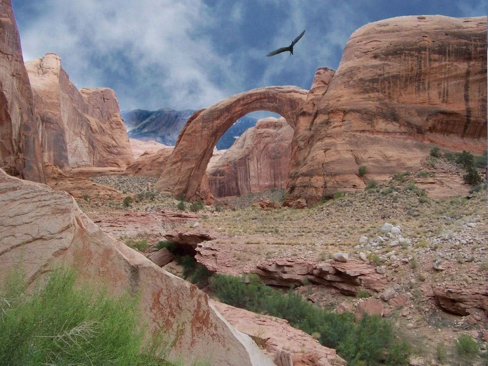
Rainbow Bridge was reached on 14 August 1909 by a party guided by the Paiutes Nasja Begay and Jim Mike with John Wetherill, and President Taft proclaimed it a national monument the following May .
The proviso, and what happened to it A PROMISE AND A COURT
The 1956 act that authorised Glen Canyon Dam contained a protective proviso for Rainbow Bridge . Congress then declined to fund the protective works for sixteen years. David Brower, by then at Friends of the Earth, sued to enforce it. He won at trial, lost on appeal precisely because Congress had refused the money, and the Supreme Court declined to hear it in 1974.
In Badoni v. Higginson, decided in 1980, the Tenth Circuit held that the government's interest in Lake Powell's storage capacity outweighed Navajo religious claims at the bridge .
How it was built, and the summer it nearly went wrong
A fight that was won somewhere else, four hundred thousand buckets of concrete, and plywood bolted to a spillway gate.
In 1950 the Interior Secretary approved a dam at Echo Park, inside Dinosaur National Monument. The conservation movement fought it and won. In 1954 David Brower stood up at a congressional hearing and showed that Reclamation had got its evaporation arithmetic wrong, and the Bureau conceded the error three months later. By late 1955 upper basin lawmakers had agreed to drop Echo Park from the bill. The Colorado River Storage Project Act was signed on 11 April 1956 without it .
Glen Canyon was in the bill. Nobody fought for it.
Was it a trade CONTESTED
The movement's own memory is that Glen Canyon was traded away for Echo Park. No document of exchange has ever been produced. Historians describe it instead as an omission: Echo Park was inside a national monument and Glen Canyon had no protective designation at all, so one had a legal argument and the other did not. Brower had at one point argued for a taller dam at Glen Canyon as the engineering substitute for Echo Park.
This page prints the disagreement rather than picking the version that reads better.
| Date | What happened |
|---|---|
| 15 October 1956 | The first blast is fired in Glen Canyon |
| 1957 | Merritt Chapman and Scott win the prime contract. The town of Page is established as a government camp for the workforce |
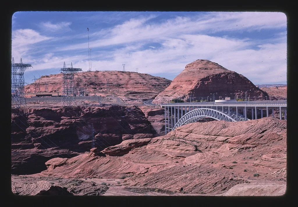
| 1957 to 1959 | The Glen Canyon Bridge is built, a steel arch spanning 1,028 feet, 700 feet above the river |
| 11 February and 19 May 1959 | The two diversion tunnels are completed |
| 16 June 1960 | First concrete placed |
| March 1963 | The diversion tunnels are closed. Lake Powell begins to fill |
| 13 September 1963 | The last of about 400,000 buckets of concrete is placed |
| 1964 | The powerplant comes online |
| 22 September 1966 | Lady Bird Johnson dedicates the dam and powerplant |
| 22 June 1980 | The reservoir reaches 3,700 feet for the first time, seventeen years after the gates closed |
Eighteen men died building it, and none of them is in the concrete A MYTH WORTH KILLING
There is a persistent story that workers are entombed in the dam. Reclamation addresses it directly and says the opposite: all of the bodies were recovered and accounted for, and no one was buried inside the dam . Eighteen workers died in accidents during construction. That is the fact worth carrying, and it does not need improving.
In the spring of 1983 the runoff came in at about 150 per cent of normal. The spillways had never really been used. On 2 June the left tunnel gates were opened. On 6 June, in Reclamation's own words, "loud rumbling noises were heard coming from the left spiliway." The spelling is the agency's.
What was happening was cavitation: water moving fast enough that the pressure drops, vapour bubbles form, and when they collapse against the tunnel lining they hammer it apart. Reclamation found that "Cavitation damage had occurred low in the vertical bend, resulting in removal of approximately 50 yd3 of concrete."
The response was plywood JUNE 1983
"Four-foot (1.2-m) high plywood flashboards were immediately installed on top of the four spillway gates." Later replaced with eight foot steel. The point of the flashboards was to hold more water in the reservoir so less of it had to go down the damaged spillways.
Inflow peaked at "111 500 ft3/s" on 27 June . By the time the spillways were shut, a hole 35 feet deep, 134 feet long and 50 feet wide had been excavated out of the sandstone below the tunnel bend .
The two dates for the peak A REAL CONFLICT
The reservoir topped out at 3,708.34 feet, its highest level ever. Reclamation's own 1984 conference paper says the peak came on 15 July 1983 . The federal survey's Lake Powell water year series says 14 July 1983 . Both are federal, both are published, and this page is not going to pick one.
The most argued over dam in the West
A verified sentence, a famous quotation that is not one, and both cases made as strongly as their own advocates make them.
The Sierra Club published Eliot Porter's The Place No One Knew in 1963, the year the gates closed. David Brower wrote the foreword. It opens:
Verified wording, 1963 first edition QUOTED EXACTLY
"Glen Canyon died in 1963 and I was partly responsible for its needless death. So were you."
What Brower did not say A QUOTE WORTH KILLING
You will see it written everywhere that Brower called Glen Canyon Dam his greatest mistake or his biggest regret, in quotation marks. We could not source those words to him. Not in his books, not in a contemporaneous article, not in the Bancroft Library oral history.
What actually exists is an advocacy organisation's narration of what he declared, written in its own words and not in quotation marks , and a different phrase, "the greatest sin I ever committed", recounted second hand from a 2016 biography.
The 1963 foreword is verified, and it is a better sentence than the paraphrase. Use that one.
Edward Abbey published Desert Solitaire in 1968 and The Monkey Wrench Gang in 1975, a novel whose organising fantasy is the destruction of this dam .
They did not crack the dam 21 MARCH 1981
On the spring equinox in 1981 about seventy five people gathered at Glen Canyon Dam. Five of them unrolled a 300 foot wedge of black plastic down the face of it, so that photographed from the right angle it looked like a crack running down the concrete. Abbey spoke .
Nothing was done to the structure. It was a photograph. It is described here as documented history, and Fathom Restoration does not endorse sabotage of public infrastructure or anything else.
This is the most argued over piece of infrastructure in the American West. Fathom Restoration takes no position on it. What follows is the strongest version of each case, in the words of the people who make it, with the other side printed beside it.
The case for draining or bypassing
Fill Mead First. The proposal, pushed by Glen Canyon Institute since 1996, is to move Lake Powell's water into Lake Mead and operate one reservoir instead of two .
The redundancy argument, which is the strong one. Two reservoirs each about a quarter full impose two sets of evaporation losses, two sets of seepage into porous sandstone, and two sets of ageing infrastructure, to store an amount of water that would fit inside one of them.
And the infrastructure argument. Reclamation's own engineers concluded in 2024 that it should "not rely on the river outlet works as the sole means for releasing water from Glen Canyon Dam" below 3,490 feet . That is the agency saying its own equipment is not built for the lake it now has.
And the canyon comes back. Cathedral in the Desert reappeared in 2005 and again from 2021, and a writer who saw it in 2005 described it as looking "almost exactly like" the photograph taken of it in 1964 .
The case against
The Compact, which is the strong one. Article III(d) of the 1922 Colorado River Compact obliges the Upper Division states not to deplete the flow at Lee Ferry below 75 million acre feet in any ten consecutive years . Lake Powell is the only physical means they have of absorbing a run of dry years without curtailing their own users.
The Congressional Research Service puts it plainly: the dam lets the Upper Basin regularly meet its obligations to the Lower Basin and Mexico, and "It is unclear what the legal or practical effects would be if low storage levels rendered the Upper Basin unable to meet its Law of the River requirements." Removing the reservoir converts a water problem into a lawsuit with no forum but the Supreme Court.
Power. Glen Canyon generation has fallen from about 4,600 gigawatt hours a year before 2000 to 2,590 in 2022 , but it has not fallen to nothing, and in 1997 the federal power marketing administration estimated a 1.3 billion dollar revenue loss over fifty years from draining .
Recreation. 5.2 million visits in 2023, 540 million dollars of spending and 6,300 jobs .
What the peer reviewed assessment actually concluded BOTH SIDES QUOTE IT
Utah State University's Center for Colorado River Studies assessed Fill Mead First in 2016 and found the water saving "would be less than ~0.05 million af/yr" . Opponents quote that as a debunking. Supporters point out that the same paper says Lake Powell's evaporation has not been measured since the 1970s, and that whether the saving justifies action is a policy question rather than a scientific one.
Both readings are accurate. That is what makes it a real argument rather than a settled one.
Two hundred and fifty years, in order
From a ford in 1776 to a reservoir two feet above its record low.
- 1776
The Crossing of the Fathers
The Dominguez and Escalante expedition, blocked by the canyons, forded the Colorado at a place later called El Vado de los Padres. It is under Padre Bay now.
- 1869
Powell names it
On 1 August John Wesley Powell named Music Temple, and on 3 August, out of a run of country he could not classify, he wrote that they had decided to call it Glen Canyon.
- 1880
Hole in the Rock
Two hundred and fifty people and eighty three wagons descended a widened slot to the river and crossed on Charles Hall's ferry.
- 1883
Cass Hite
Hite settled in Glen Canyon and set off a small gold rush at the place that took his name.
- 1909
Rainbow Bridge is reached
A party guided by the Paiutes Nasja Begay and Jim Mike with John Wetherill reached the bridge on 14 August. Taft proclaimed it a national monument the following May.
- 1922
The Compact
Seven states apportioned 7.5 million acre feet to each basin, on an assumed river of 16.4 million. The river has not delivered that on average since.
- 1956
Congress authorises the dam
The Colorado River Storage Project Act was signed on 11 April, after Echo Park had been fought off and Glen Canyon had not been. The first blast was fired on 15 October.
- 1963
The gates close
The diversion tunnels were shut in March and the reservoir began to fill. The last of about 400,000 buckets of concrete went in on 13 September. Eighteen workers had died.
- 1966
Dedication
Lady Bird Johnson dedicated the dam and powerplant on 22 September.
- 1972
The recreation area
Glen Canyon National Recreation Area was established on 27 October.
- 1980
Full, at last
The reservoir reached 3,700 feet on 22 June, seventeen years after the gates closed. In November the Tenth Circuit decided Badoni v. Higginson against Navajo religious claims at Rainbow Bridge.
- 1983
The spillways
Gates opened 2 June, cavitation damage found 6 June, inflow peaked at 111,500 cubic feet per second on 27 June, and the reservoir topped out at 3,708.34 feet in mid July. Still the record.
- 1992
The Grand Canyon Protection Act
Congress required the Secretary to operate the dam so as to protect and improve the values for which Grand Canyon National Park and Glen Canyon National Recreation Area were established.
- 1996
The argument becomes organised
The first experimental high flow release ran in March and April. Glen Canyon Institute was founded. In November the Sierra Club board adopted a position in favour of draining Lake Powell.
- 1997
Congress holds a hearing on draining it
A joint House hearing on 24 September examined the proposal. Reclamation called it unrealistic and the federal power marketing administration estimated a 1.3 billion dollar revenue loss over fifty years.
- 2005
A record low, and a canyon comes back
The lake fell to about 3,555 feet in April, then the record, and Cathedral in the Desert briefly reappeared.
- 2007
The Interim Guidelines
Signed 13 December, coordinating Powell and Mead and setting Lower Basin shortage tiers. They govern operations through 2026.
- 2016
Fill Mead First is assessed
Utah State University published a technical assessment concluding the water saving would be under about 50,000 acre feet a year.
- 2021
The first shortage declaration
Powell fell below the 2005 record in July. On 16 August Reclamation declared the first ever Level 1 shortage at Lake Mead. Gregory Natural Bridge and Cathedral in the Desert re emerged.
- 2022
Emergency operations, and the sediment number
On 3 May Reclamation held back 480,000 acre feet and released about 500,000 from Flaming Gorge to defend 3,490 feet. In March the federal survey reported the reservoir had lost 6.79 per cent of its capacity to sediment between 1963 and 2018.
- 2023
The record low, and a Supreme Court decision
The lake bottomed at 3,519.92 feet in April. In June the Supreme Court decided Arizona v. Navajo Nation, five to four. In April an inspection found fresh cavitation damage in the river outlet works.
- 2026
No consensus, and a falling lake
The basin states missed the February deadline and Interior proceeded anyway. In April Reclamation cut the annual release to 6.0 million acre feet and ordered more water from Flaming Gorge. By early August the lake was within about two feet of its all time low.
A canyon nobody protected, a dam nobody can agree about, and a lake holding a quarter of what it was built for.
Fathom Restoration is a Utah 501(c)(3) that runs volunteer dive cleanups and is built to pull what does not belong out of Utah water, statewide.
Donate to Protect Lake PowellThe Water
The Compact, the crisis, the sediment, the outlet works, and what happens below 3,490 feet. Every number an agency publishes, including the ones that contradict each other.
Recreation
Ramps, marinas, two states and one licence, the fish, and the single boat ramp still open on a 186 mile lake.
Every figure on this page is quoted from the source named beside it.
Sources
How these were checked
Every figure is quoted from the sentence or the database field it appears in. Numbered sources are agencies, courts and Congress, and they are the only thing behind a fact, a number or a legal statement. Lettered sources are everything else, including advocacy organisations and journalism, and they are used for the history of the argument rather than for its facts. Where sources disagree, all of them are printed. On this page that happens over the surface area, the storage capacity, the date of the 1983 peak, and whether Glen Canyon was traded away or simply not defended.Glen Canyon Dam, facts and figures
National Inventory of Dams, record AZ10307 Glen Canyon Dam
Dams database, Glen Canyon Dam
Glen Canyon Unit, project history
Elevation area capacity relationships of Lake Powell in 2018, Scientific Investigations Report 2022 to 5017
Glen Canyon National Recreation Area, park statistics
Changing lake levels
Colorado River Storage Project Act, 1956
Colorado River Compact, 1922
Hole in the Rock
Rainbow Bridge National Monument, history and culture
Powell's 1869 river journey
Glen Canyon Archeological Salvage Project records, finding aid MS 102
Glen Canyon National Recreation Area enabling act, 16 U.S.C. 460dd
Badoni v. Higginson, 638 F.2d 172, Tenth Circuit, 1980
Grand Canyon Protection Act, 1992
Operation of Glen Canyon Dam Spillways, Summer 1983, paper PAP 0714
Lake Powell water year maximum and minimum time series
Lake Powell at Glen Canyon Dam, gauge 09379900
Joint hearing on the Sierra Club's proposal to drain Lake Powell, 24 September 1997
Fill Mead First, a technical assessment, 2016
Glen Canyon Dam and Lake Powell, report R47497
Colorado River post 2026 operations
News release 5326, 17 April 2026
Interim operating guidance for Glen Canyon Dam at low reservoir levels, technical decision memorandum, 2024
Arizona v. Navajo Nation, 599 U.S. 555, 2023
National Hydrography Dataset, Lake Powell water body, COMID 3528295
Upper Colorado hydrologic data, Lake Powell site 919
The Place No One Knew, Glen Canyon on the Colorado, 1963, foreword by David Brower
Edward Abbey and the spring equinox at Glen Canyon Dam, 1981
Why Glen Canyon, and the history of the river restoration movement
Glen Canyon and Edward Abbey
Voices of a drowned treasure, the Music Temple register
The brief but wonderful return of Cathedral in the Desert
Colorado River developments and potential compact litigation
The Wilburys system crash paper, June 2026
What these numbers are measuring
The elevation card is the whole story of this lake. It reads the federal survey gauge on the reservoir at Glen Canyon Dam . That gauge has only been reporting since April 2019, which is why the long chart on this page uses a different federal series for everything before that . Reclamation separately publishes its own daily record for this reservoir going back to 28 December 1963 .
Below full pool is arithmetic, not a measurement. It is 3,700 feet minus the gauge reading. Full pool is the top of the spillway . Note that the federal survey states full pool as 3,702.91 feet on a newer vertical datum , so the two figures are about three feet apart before anyone measures anything.
The flow card is below the dam, not on the lake. It is the Colorado River at Lees Ferry , about fifteen miles downstream, and it is the number the whole Lower Basin is watching.
Everything from these gauges is provisional until the survey reviews it, and the cards say so when the data does.
The forecast is the National Weather Service point forecast for the middle of the lake . Note the lake spans two forecast offices, so the Wahweap end and the Bullfrog end can carry different products.