
SAND HOLLOW
A Cessna, a cabin cruiser and a Volkswagen bus
Utah's most developed purpose built dive park, in warm clear water, thirteen miles from St George. Almost nothing about it is written down by the agency that manages it.
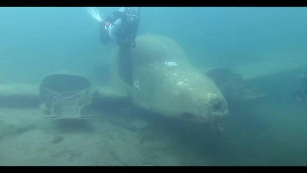
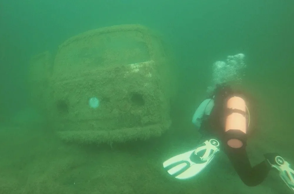
Sand Hollow holds the most developed purpose built dive park in Utah. Objects were sunk in a buoyed no boating zone just south of the main boat ramp, and you swim to them from shore.
| What is down there | Detail | Placed | Depth |
|---|---|---|---|
| Twin engine Cessna | Reported variously as a 310 or a 320. No agency source names either. | Placed 2006 by a local dive shop | About 40 ft |
| 26 ft Reinell cruiser | Sits at the base of what divers call Birthday Rock. | Placed September 2014 by Washington County Search and Rescue | About 60 ft |
| 1969 Volkswagen bus | Driven into the water from shore, then moved deeper in 2014. | Placed around 2009 | About 30 to 40 ft |
| An air tank with fins welded to it | Known locally as the bomb. | Unknown | About 30 ft |
| A toilet | A white toilet. Nobody has explained it. | Unknown | About 30 ft |
| Buoyancy course | Vertical and sloping pipes with about five hoops to swim through. | Unknown | About 28 to 40 ft |
| Training platform | With a buoy on it. | Unknown | About 30 ft |
The aircraft model is genuinely unresolved. Sources split about evenly between a Cessna 310 and a Cessna 320. They are closely related twins, which is presumably how the confusion started, and this page is not going to pick one.
| Figure | Source | |
|---|---|---|
| Training bench | About 28 to 30 ft | Dive sources |
| Deepest inside the buoyed dive park | About 45 ft, varies with the lake level | Dive sources |
| Deepest water in the reservoir | About 95 ft at the North Dam, 55 at the West Dam. A boat dive, not the dive park | Dive sources |
| Visibility | Consistently reported at 15 to 20 ft | Dive sources |
| Surface temperature, summer | 75 to 80 degrees Fahrenheit | Dive sources |
| Surface temperature, winter | Around 54 degrees | Dive sources |
| Thermocline | Around 20 ft in high summer, deeper later in the season. Below it, mid 60s | Dive sources |
That last row is the one that catches people. The attractions sit below the warm layer. The Cessna at forty feet and the Reinell at sixty are in mid sixties water on a day when the surface is eighty. Choose the exposure suit for the depth, not for the walk down the beach.
Utah State Parks gives the park elevation as 3,000 feet . The federal survey records the reservoir surface rising to about 3,060 feet when it first filled in May 2006 .
It matters more than usual here because of who dives it. St George pulls divers up from Las Vegas, which sits at about two thousand feet, and takes people straight from the car to the water. Arriving at altitude and diving immediately is its own consideration, and so is flying afterwards.
Nothing on this page is dive instruction or a dive plan. Altitude diving is a certification.
- Shore entry, south of the main boat ramp, inside a buoyed combined swim and dive zone that keeps boats out .
- Day use in 2026: 25 dollars a vehicle for Utah residents, 35 for non residents, 10 for Utah seniors, 5 walk in . A resident annual pass is 125 dollars and pays for itself in five visits.
- Divers pay nothing extra. There is no dive fee, dive permit or dive registration on the official fee schedule . The only special permit listed is a five day drone permit at 15 dollars.
- Air fills and rentals are available at a shack on site run by a local shop, with more shops in St George about fifteen miles west. Call ahead rather than assuming the shack is open.
The ten dollar entrance fee quoted on several dive pages is a decade out of date. It is 25 and 35 now . Spearfishing is not permitted.
Put the last four panels together and the picture is odd. Utah has a purpose built underwater attraction park, in warm clear water, open year round, with an aircraft and a boat and a bus in it, thirteen miles from St George. The managing agency lists it as a two word activity and publishes nothing else.
There is no state published dive map. No attraction list. No depth chart. No maintenance agreement between the park and any dive shop or club that could be documented. The objects were put there by a local shop and by the county search and rescue dive team, evidently with the park's cooperation, and the only written record of what is down there is a newspaper article from 2016 .
What Sand Hollow is
A reservoir built to leak, sitting on a sandstone aquifer that holds six times what the surface does.
Sand Hollow is an off channel reservoir finished in March 2002 for 37.3 million dollars . Nothing flows into it. Water is taken off the Virgin River at the Quail Creek Diversion Dam and run 8.7 miles through a 66 inch steel pipeline, through a hydropower plant, and into the reservoir through a 60 inch inlet in the North Dam .
That pipeline does not end here. The water district describes the same line as delivering to "Sand Hollow and/or Quail Creek reservoirs" . One diversion on the Virgin River, one pipe, one power plant, two reservoirs. The other one is the one whose dike broke on New Year's Day 1989, and it has its own page: Quail Creek Reservoir. A third Washington County reservoir, Gunlock, is on a different river and shares this one's fishing rules rather than its plumbing.
The federal survey has measured what actually goes down:
| Period | Recharged to the aquifer |
|---|---|
| 2002 to 2009 | About 86,000 acre feet measured, about 94,000 simulated |
| 2002 to 2018 | About 159,000 acre feet |
| Annual range, 2002 to 2016 | About 5,400 to 18,200 acre feet a year |
| Diverted in from the Virgin River, 2002 to 2018 | About 288,000 acre feet |
It comes back out through 13 production wells in the sandstone, plus french drains near the dams and a spring drain system. About 46,000 acre feet were pumped back out between January 2004 and December 2018 . The state engineer runs monthly storage accounts on it, tracking what was recharged, what was recovered and what was lost back to the river .
| North Dam | West Dam | |
|---|---|---|
| Federal record | UT50414 | UT50414S001 |
| Height | 98 ft | 51 ft |
| Length | 3,221 ft | 7,638 ft |
| Hydraulic height | 91 ft | 44 ft |
| Condition assessment | Satisfactory, assessed 2002 | Satisfactory, assessed 2002 |
| Last inspection | 24 October 2023 | 24 October 2023 |
Both were finished in 2002 and both are recorded as off channel . The North Dam is nearly twice the height and less than half the length of the West Dam, which is why the deep water sits at the north end and the dive park does not.
The condition assessments on both records are dated 2002, which is the year they were built. The inspections are current. Those are different fields and it is worth not reading the first as a 2023 judgement.
| Figure | Value | Source |
|---|---|---|
| Capacity | 51,360 acre feet | The water district , and the Corps of Engineers as normal storage |
| Capacity, maximum | 60,958 acre feet | Corps of Engineers |
| Surface area | 1,322 acres | Utah State Parks |
| Surface area | About 1,330 acres at its 2017 to 2018 maximum | USGS |
| Surface area | 4.76 square kilometres, about 1,176 acres | USGS national hydrography dataset |
| Full pool elevation | 3,067 ft | USGS, 2005 |
| Full pool elevation | About 3,060 ft, reached May 2006 | USGS |
| Park elevation | 3,000 ft | Utah State Parks |
The surface area spread is the awkward one. The federal mapped polygon is about 12 percent smaller than the state park figure. On a reservoir that grew from 240 acres in 2002 to about 1,330 by 2018 , that is probably two snapshots of a filling lake rather than two measurements of the same thing, and this page prints both rather than choosing.
On 21 May 2010 a single live adult quagga mussel, about two centimetres, was found on a submerged structure at a boat dock at Sand Hollow. The state issued an emergency decontamination order covering any boat that had been on the reservoir in the previous thirty days.
The reversal is complete enough that Sand Hollow now hosts one of the five decontamination dip tanks in the state programme . The water that was quarantined in 2010 is where other people's boats get cleaned in 2026.
Precision matters on this one, because it gets retold badly. One adult on a structure. No larvae based finding, no reproducing population, no established infestation, and a delisting after negative monitoring. An exact dated delisting notice could not be sourced.
The numbers, and the gauge that is not here
One monthly storage figure, one river gauge, a percent full number that disagreed with itself three times in one morning, and an algae advisory that was on the bottom rather than in the water.
The only routinely updated number is a monthly storage figure, station 09UTSAND:UT:BOR, published by the USDA soil conservation service . The daily and semimonthly series it declares both return empty. Monthly is what exists.
The live number on this page is therefore the river, not the reservoir: USGS 09408150, Virgin River near Hurricane , which sits just below the diversion area that fills Sand Hollow. It tells you what is available to divert. It does not tell you how full the reservoir is.
The water district publishes no current level or storage of its own .
The shoreline at the top is traced from OpenStreetMap , which is not an agency.
| Check | Result |
|---|---|
| Shape ratio against the USGS mapped extent | 1.070 traced against 1.063 published, a difference of 0.7 percent |
| Traced area | 4.70 square kilometres, about 1,162 acres |
| Against the USGS polygon, 4.76 | 1.3 percent smaller |
| Against the state park 1,322 acres | 12 percent smaller |
The trace lands almost exactly on the federal polygon and about 12 percent under the state park figure, which is the same 12 percent those two disagree with each other by. The outline is not the odd one out. The two agency figures are.
Identifiers: GNIS feature 02829472, reach code 15010008008373, and a permanent identifier rather than a COMID on the high resolution layer . Note the small scale layer contains no Sand Hollow feature at all, so a query written against it returns nothing.
Sand Hollow carried a warning advisory from 23 October 2024, lifted on 3 December 2024 after treatment .
For a diver that distinction is not academic. Benthic mats are on the bottom, which is where you are.
No advisory has been posted for 2026 as of this page being written, and no cell counts or toxin concentrations are published for Sand Hollow at all . The state's warning threshold is more than 20,000 cyanobacteria cells per millilitre, or microcystin above 4 micrograms per litre, or any detection of anatoxin-a .
No fish consumption advisory exists for Sand Hollow . The park also publishes that swimmer's itch is active whenever the water is above 65 degrees , which is most of the diving season.
Where everything is
Seven places, and the dive park is not one the state will give you a coordinate for.
What to watch for
Three drownings here in one summer, and not one of them was a diver.
- 4 May 2024. Christian Jeffrey Fisher, 18, of Las Vegas, was "swimming with friends in the dive park area". His friends saw him struggle to keep his head above water. "He was not wearing a life jacket at the time of the incident." He was found about two hours later .
- 6 August 2026. A 19 year old man from Nevada was swimming near the dive park, went under and did not resurface. A life jacket was not worn. Bystanders pulled him out and performed life saving measures .
No publicly reported scuba fatality at Sand Hollow could be found, in agency releases or in news coverage. That is stated as not found rather than as never happened, because the state does not publish a complete incident record.
The reason the confusion happens is a name. The buoyed zone is a combined swim and dive area, and the agency calls the whole thing the dive park. A swimmer drowning inside it produces a headline that reads as though a diver died. One outlet covering the 2026 death added that it was "not clear if he had been diving", which is the only wobble in otherwise consistent reporting, and it is contradicted by the wording in the state release every other outlet reproduced.
By 8 August 2026 the state was publicly counting three drownings at Sand Hollow that summer . A Utah natural resources captain put it plainly: these circumstances should never feel normal, and people should not simply expect to see drownings.
The earlier record, all from state park releases:
| Date | What happened |
|---|---|
| 27 Feb 2020 | A body recovered at the jumping rocks on the northeast side, about 15 feet from shore in 13 feet of water |
| 5 Oct 2020 | Two personal watercraft collided above wakeless speed. Six people involved, all six wearing life jackets. An eleven year old boy died of injuries |
| 25 Jun 2022 | A twenty year old swimming near the jumping rocks began struggling. Not wearing a life jacket |
| 3 Aug 2023 | A fifteen year old fell from a paddleboard at the south beach and did not resurface. Recovered from 25 feet of water. Not wearing a life jacket |
| 4 May 2024 | The dive park drowning above |
The park keeps free loaner life jackets in all sizes at the visitor centre . A state officer's own framing after the 2026 death was that even a strong swimmer is at risk, even in five feet of water. Two more people needed pulling out of this reservoir on a single Saturday in July 2026, one a swimmer who became exhausted and one thrown from a boat .
- Swimmer's itch is active whenever the water is above 65 degrees , which covers roughly June to September. It is a parasite reaction, it is not dangerous, and it is miserable.
- This reservoir is Washington County's drinking water. Refuelling watercraft on it is prohibited and decontamination runs year round .
- Boat traffic is heavy in summer and the reservoir is busy. The dive park sits inside a no boating zone, which is the main reason it works as a shore dive.
- State rule sets the diver down flag and requires vessels to stay 150 feet clear of a posted flag . Inside the buoys that is a boundary protection. Outside them it is the only thing between you and a propeller.
This page does not carry a fish list. Utah State Parks' own page for Sand Hollow does not mention fishing at all , and no fishery monitoring report for this reservoir could be sourced. Read the current Utah Fishing Guidebook rather than trusting a list assembled from nothing.
Nobody stocked those smallmouth. The state's own aquatic program coordinator said so on the record in 2011, about this reservoir and about the one at the other end of the pipeline . The reason is the Virgin River below them, where six native fish are being recovered.
Spearfishing is a separate matter: Sand Hollow does not appear in the guidebook's underwater spearfishing list at all . Quail Creek does, for smallmouth bass only.
Gunlock is what happens when the rule fails. In October 2015 the state treated that entire reservoir with rotenone to remove its smallmouth, killing everything else in the water with them . It was refilled partly with adult largemouth bass caught here in Sand Hollow and driven over. The whole account is on the Gunlock page.
We went looking for trash and came up almost empty
Three certified volunteers, diving on their own time, spent a morning on the dive park's plane and boat and kept their eyes on the bottom for anything that did not belong. The whole haul was one food wrapper and some fishing line. A week earlier, one small area of Deer Creek gave up roughly 40 pounds.
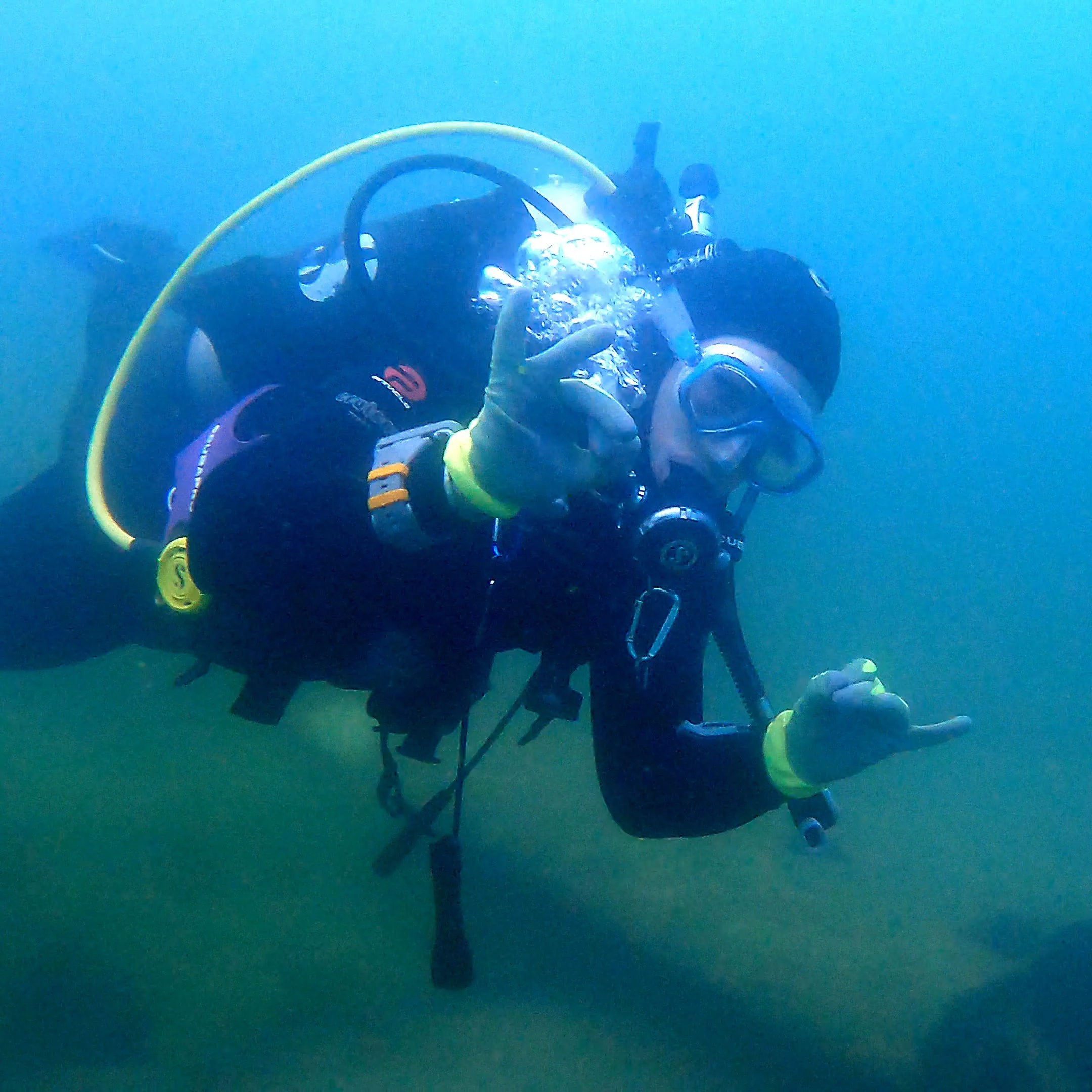
That gap is the story. The people who dive this park treat it like it belongs to them. They pick up after themselves, and after whoever was there before them. You can see it on the bottom. A clean reservoir is what happens when enough people decide a piece of water is theirs to take care of, and this one shows it works.
Read the full storyThere was no publicly available photograph of what is on the bottom of this reservoir. So our divers went down and took some.
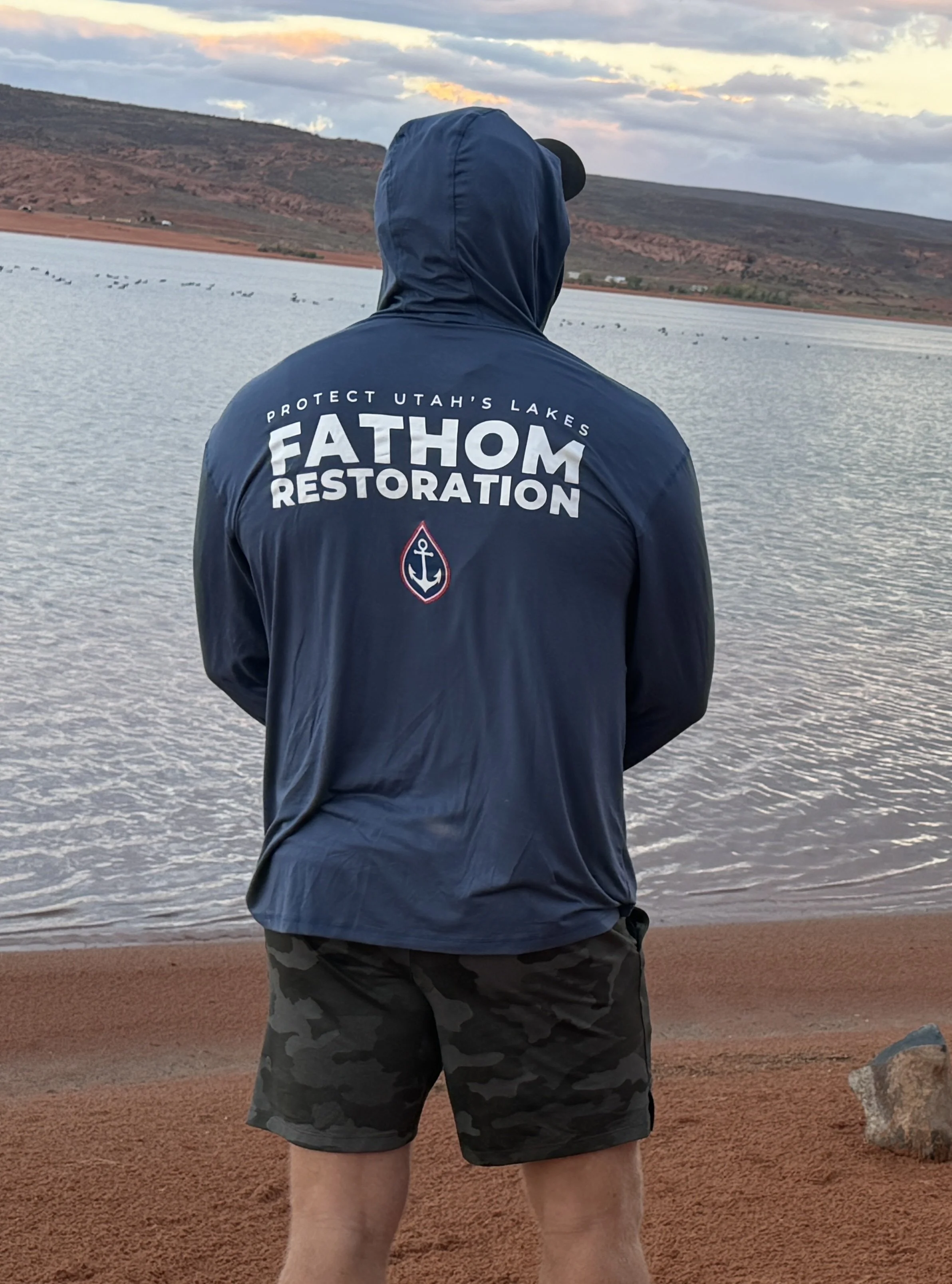
Fathom Restoration is a Utah 501(c)(3) that runs volunteer dive cleanups and is built to pull what does not belong out of Utah water, statewide.
Donate to Protect Sand HollowEvery figure on this page is quoted from the source named beside it.
Sources
How these were checked
Numbered sources are agencies. Lettered sources are everything else. On this page the lettered ones carry more weight than usual and that is deliberate: the dive park depths, temperatures, visibility and the entire list of what is sunk in it exist only in dive shop guides, a dive club site and a 2016 newspaper article. Utah State Parks confirms the dive park exists, names it in its own releases, lists scuba as an activity, and publishes nothing else. Where agencies disagree, all of them are printed. On this page that happens over the surface area, the full pool elevation, the capacity and the percent full figure the park itself publishes three different ways.What these numbers are measuring
None of these is the reservoir. No gauge has ever reported the water level or storage of Sand Hollow. The two federal sites on it are discrete water quality sampling points and both are inactive .
The card above reads the river that fills it. USGS 09408150, Virgin River near Hurricane, just below the diversion area . It tells you what is available to divert, not how full the reservoir is or how deep the dive park is.
Gage height is not depth. It is a height above that station's own datum and it means nothing without the rating behind it.
For how full the reservoir is, the only routinely published figure is monthly, from the USDA soil conservation service station 09UTSAND:UT:BOR . The state park also publishes a percent full number on its pages, but three of those pages returned three different values within minutes of each other .