
TIBBLE FORK
What happened at Tibble Fork
A small alpine reservoir at the top of American Fork Canyon, rebuilt in 2016, and the only water on this site that comes with a state enforcement file.
Tibble Fork is Fathom Restoration's first official cleanup site. It is a small alpine reservoir at the top of American Fork Canyon, non motorised, ringed by a car park that fills by nine on a summer Saturday, and cold enough year round that diving it is a drysuit job.
It is also the only water in this series with a state enforcement file attached to it. In August 2016 the reservoir was drained for a dam rebuild, the sediment behind the dam went down the river with the water, and roughly five thousand two hundred trout died in two miles of the North Fork of the American Fork River . The state cited the dam owner for six violations and settled for a hundred and forty five thousand dollars .
- 19 to 20 Aug 2016
Drawdown begins
Crews start emptying the reservoir for the dam rehabilitation. Utah DWQ uses 20 August in one document set and 22 August in another. Neither is corrected anywhere.
- 22 Aug 2016
The river turns
The sediment slug reaches the North Fork of the American Fork River. DWQ dates the discharge itself to this day in its public enforcement summaries.
- 23 Aug 2016
The fish are found
An angler finds the kill. Utah DWR and Trout Unlimited survey the following day and count dozens of dead brown and rainbow trout over two miles.
- 26 to 27 Aug 2016
Sampling
DWQ collects samples. Metals below the reservoir come back two to ten times higher than metals above it.
- 8 Sep 2016
Bypass built
A bypass channel is completed and water quality improves noticeably.
- 12 Sep 2016
Back in compliance
The river recovers to the point that the operators are no longer in violation of turbidity and total suspended solids standards.
- 27 Sep 2016
Six violations
DWQ issues a notice of violation and compliance order to the North Utah County Water Conservancy District citing six violations, including unauthorised discharge, pollution of waters of the state, and breach of the antidegradation policy. The department dates the order to the 27th and it was reported publicly on the 28th.
- 31 Oct 2016
The district appeals
NUCWCD files a request for agency action seeking administrative review. This is an appeal inside the department, not a court case.
- 30 Mar 2017
Settlement posted
A 52,500 dollar civil penalty plus 92,633.55 dollars reimbursed to DWQ for sampling and monitoring. 145,133.55 dollars in total, and a remediation and monitoring plan.
- May 2017
Signs come down
Warning signs telling children to stay out of the American Fork River are removed after sampling comes back within range.
- Jun 2017
The reservoir reopens
After a year of construction the rebuilt reservoir opens to the public, fifteen feet taller and with more than double the pool.
- Aug 2018
Fish in every age class
DWR electrofishes the recovering reach and finds brown trout of ten to twelve inches, rainbow trout and mottled sculpin across all age groups.
- Mar 2023
The health review
Utah health authorities publish a consultation on the release, seven years after it happened.
This is where most accounts of Tibble Fork go wrong, so it is worth separating carefully. American Fork Canyon has a long hardrock mining history and the sediment behind the dam carried metals from it. What follows is what an agency measured.
- Measured, water column, 23 August 2016: dissolved and total metals below the reservoir came back two to ten times higher than above it .
- Also measured, same samples: total metals in the water column on 22 and 23 August did not exceed human health screening values for recreational exposure .
- Volume: the state gives roughly 5,100 cubic yards of contaminated sediment in one document and about twelve million pounds in another . Those are the same event described in two units by two arms of the same department, and neither reconciles them.
- Removal: forty six truckloads were hauled out before the following spring runoff .
Utah health authorities returned to it in a formal consultation published in March 2023, seven years after the event .
It is widely assumed there was a lawsuit. There does not appear to have been one. No civil litigation, no Clean Water Act citizen suit and no notice of intent to sue could be found. The only adjudicative process on the record is the request for agency action that the water district filed with the department on 31 October 2016, which is an internal administrative appeal, and it was resolved by the 2017 settlement rather than by a decision .
The department's own published list of administrative proceedings and decisions carries no Tibble Fork entry at all .
What the settlement did require is on the record. The district had to submit a comprehensive monitoring plan for sediment and water in the affected part of the drainage, and to keep monitoring until concentrations met estimated pre release conditions and the state accepted that they had . Sediment removal was to be repeated annually until metals returned to background levels, alongside a fish health plan and a fish population recovery plan .
Stated as an absence rather than a finding. A case that settled quietly, or one filed in a court whose records are not indexed publicly, would not show up in the sources checked here. The citation itself was reported in the press on 28 September 2016 .
The rehabilitation was funded by the federal soil conservation service under the 1954 watershed protection law and carried out for the North Utah County Water Conservancy District, which owns the dam . The Forest Service is the landowner, not the operator .
The case for doing it was downstream: the agency records the dam as protecting a hundred and forty houses, two schools, four businesses and three highways, and puts the extension of the dam's life at fifty nine years .
The reservoir behind it was also filling with its own canyon. Sediment was arriving at roughly 2.8 acre feet a year with about 151 acre feet already in place . Raising the crest fifteen feet bought back storage that the mountain had been taking away.
| Before | After | |
|---|---|---|
| Dam crest elevation | 6,394.5 ft | 6,409.5 ft |
| Surface area | 9.8 acres | 21.6 acres |
| Beach | None recorded | About one acre added |
| Parking | Not recorded | 60 cars and 25 truck and trailer spaces |
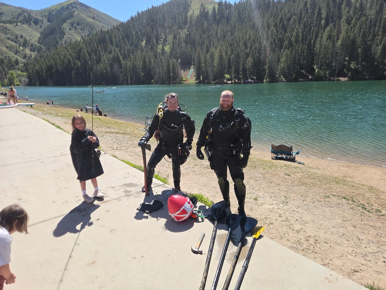
Tibble Fork is our first official cleanup site
Forty four degree water in May, six thousand four hundred feet of altitude, and a drysuit. This is the reservoir Fathom Restoration dives, and the one the rest of this page is written about.
Check out our work at Tibble ForkThe numbers, and the map that is out of date
The federal outline for this reservoir predates the rebuild that doubled it, three documents disagree about how tall the dam is, and nothing measures the water itself.
The only federal water body polygon for Tibble Fork was captured on 1 August 1999 and carries an area of 0.055 square kilometres, about 13.6 acres . The 2016 rehabilitation raised the dam fifteen feet and took the reservoir from 9.8 acres to 21.6 .
It can be sanity checked even without a modern agency polygon, by asking what scale the traced shape would have to be at to match each published area:
| If the traced outline is this area | It implies this much reservoir east to west |
|---|---|
| 21.6 acres, the area after the rebuild | about 718 metres |
| 13.6 acres, the 1999 federal polygon | about 570 metres |
| 9.8 acres, the area before the rebuild | about 484 metres |
The 1999 polygon's own extent measures about 454 metres east to west. That is close to the pre rebuild figure and nowhere near the post rebuild one, which is what you would expect, and it is the only confirmation available that the two datasets are describing different reservoirs rather than disagreeing about the same one.
USGS identifiers if you want to pull it yourself: GNIS feature 1447850, NHD COMID 10327789, reach code 16020201000829 . There is no permanent identifier on that layer.
| Figure | Value | Source |
|---|---|---|
| Dam height | 49.5 ft register height, 50 ft structural | Corps of Engineers |
| Dam height, before the rebuild | About 52 ft | Geologic evaluation , and the environmental assessment |
| Crest length | 520 ft | Corps of Engineers |
| Crest length | 455 ft | Geologic evaluation |
| Storage | 610 acre feet maximum, 380 normal | Corps of Engineers |
| Storage | 166 acre feet at spillway crest, 366 at dam crest | Geologic evaluation |
| Storage | 108 acre feet before, 384 proposed | Environmental assessment |
There is no published maximum depth. The dam register lists a hydraulic height of 40 feet, which is a dam parameter and is not the depth of the reservoir . This page prints no maximum depth, because no agency publishes one.
That one is USGS 10164500, American Fork above the upper powerplant . It carries real time discharge and gage height since 2011, and daily discharge back to 1 January 1927, which makes it one of the longest continuous records in the state at over ninety nine years.
It sits at 40.4477 north, 111.6821 west, roughly four miles down canyon and below the reach the 2016 release killed. It is the number in the card at the top of this page, and it is telling you what the canyon is doing, not what the reservoir is doing.
Water quality sampling at that site ran from 1971 and appears to have stopped on 11 December 2023. The major ion and nutrient series ended around 1981.
Getting on the water
Ten dollars a vehicle, no motors, no drinking water, and a car park that is towed aggressively.
Up American Fork Canyon on State Route 92, then north. The Forest Service charges by the vehicle, not by the person :
| Pass | 2026 price |
|---|---|
| Three consecutive days | 10 dollars per vehicle |
| Seven consecutive days | 20 dollars per vehicle |
| Annual | 60 dollars per vehicle |
| Interagency America the Beautiful pass | Honoured |
Forest passes are not valid in Mill Creek Canyon or at concessionaire run campgrounds and day use sites, and the forest annual pass cannot be upgraded to the interagency one .
- No motors. The Forest Service states it as no motorised use on the banks or the reservoir . Non motorised craft are fine.
- Vault toilets. No potable water at the site . Bring your own.
- Open year round .
- Dogs on leash, no alcohol, no fires, no glass .
Granite Flat Campground sits a mile on past the reservoir and is seasonal. The Forest Service publishes no nightly rate for it and no coordinate, and directs bookings to the federal reservation service .
This is a cold water dive at altitude and it should be planned as one. The reservoir sits at about 6,400 feet above sea level, which is what the crest elevation of 6,409.5 feet implies , and the water stays cold through the summer. Fathom has recorded 44 degrees Fahrenheit on a May dive here.
Altitude changes the dive tables before it changes anything else, and the surface interval and ascent rules that work at sea level do not apply at six and a half thousand feet. Cold water rated regulators and a drysuit are the baseline here, not the upgrade.
Fathom Restoration runs volunteer dive cleanups. Nothing on this page is dive instruction, and altitude diving is a certification, not a technique you read about.
Fishing Tibble Fork
Three trout and one small fish that matters more than the other three, because it is the one that proves the riverbed came back.
Rainbow trout
Named by DWR for the reservoir, and one of the two species counted dead in the river in 2016. Back in every age class by 2018.
4 trout combined, statewide limitBrown trout
The other species in the 2016 kill. DWR found browns of ten to twelve inches in the recovering reach two years later.
4 trout combined, statewide limitBonneville cutthroat trout
Named by DWR for the reservoir and for the creek. Utah's state fish.
4 trout combined, statewide limitMottled sculpin
Not a sport fish and not stocked. It turns up in DWR electrofishing in the river below the dam, which is the useful part: sculpin do not travel, so finding them is evidence the streambed itself came back.
No limit, and no reasonAmerican Fork Creek does get an entry, pointing at the Utah Lake tributaries rule . That rule allows underwater spearfishing for white bass and northern pike in listed tributaries west of Interstate 15 and permits it for no other species. None of that is relevant up at the reservoir, and it is noted here only because the creek and the reservoir are often quoted as if they carried the same rules.
DWR reports the reservoir typically freezes in the first part of December, reaching eight to ten inches of ice by the end of that month and sixteen to eighteen by the end of February, and that the road and car park are normally plowed through the winter .
Utah DWR runs a public stocking database. Its table is built in the browser and truncates alphabetically before it reaches entries beginning with T, across every query tried. So there are no verified stocking dates, species or quantities for Tibble Fork on this page.
That is a gap, and it is printed as a gap rather than filled from an angler site. If you need it, the database has to be queried by hand in a browser.
One stocking related thing is documented. Before construction, the environmental assessment committed to salvaging the fish in the reservoir and moving them either downstream of the dam or into Silver Lake Flat Reservoir .
What to watch for
Cold water at altitude, no drinking water, and a plowed road that puts people on early ice.
This is an alpine reservoir a little over six thousand four hundred feet up, fed by snowmelt out of the Wasatch. It does not warm up the way a valley reservoir does. Fathom logged 44 degrees Fahrenheit in it in May.
Cold water takes the breath first and the hands second. Neither of those is about how strong a swimmer anyone is. If you are getting in, get in slowly, and if you are on it in a boat, the life jacket is worth more here than almost anywhere else in this series, because the water is cold enough to end a swim before the shore gets closer.
- No potable water . There is nowhere to fill a bottle.
- Vault toilets only.
- No motors, so no powered rescue on the water beyond what other visitors have with them.
- No lifeguard, and no agency publishes an incident record for this reservoir.
Mobile coverage in the upper canyon is unreliable. Plan on being unable to call from the shoreline.
DWR describes ice forming in early December and reaching sixteen to eighteen inches by late February . Those are typical figures from a fishing forecast, not a safety measurement, and nobody publishes a live ice thickness for this reservoir. Early and late season ice is the dangerous kind and the agency numbers above will not tell you which one you are standing on.
The road and the car park are normally plowed , which means the reservoir is reachable in winter by people who have not thought about ice at all.
Five thousand fish died here in 2016, and by 2018 the state was finding trout in every age class again.
Fathom Restoration is a Utah 501(c)(3) that runs volunteer dive cleanups and is built to pull what does not belong out of Utah water, statewide. Tibble Fork is our first official cleanup site.
Donate to Protect Tibble ForkEvery figure on this page is quoted from the source named beside it.
Sources
How these were checked
Every figure is quoted from the sentence or the database field it appears in. Numbered sources are agencies. Lettered sources are everything else, and on this page they carry the 2016 fish count and the recovery reporting, because the departments involved released those figures through the press rather than in a technical report that could be found. Where agencies disagree, all of them are printed. On this page that happens over the date of the release, over the height of the dam, over its storage, over the volume of sediment, and over the surface area of the reservoir before and after it was rebuilt.What these numbers are measuring
Nothing measures Tibble Fork Reservoir. There has never been a federal gauge on it, and there has never been one on the North Fork of the American Fork River, which is the reach the 2016 release killed. A search of every federal site in Utah County, active and discontinued, returns one gauge on this whole river system .
That gauge is four miles down canyon and below the damage. USGS 10164500, American Fork above the upper powerplant, at 40.4477 north and 111.6821 west. It has real time discharge and gage height since 2011 and daily discharge since 1 January 1927 . It tells you what the canyon is carrying. It cannot tell you anything about the reservoir.
There is no water level card on this page because there is no water surface elevation published for this reservoir by anyone. The elevations that exist are dam crest figures, and the two agency documents that give one do not agree with each other.